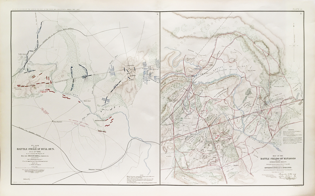


Plans of the Battlefield at Bull Run and Manassas (1891)
$175.00
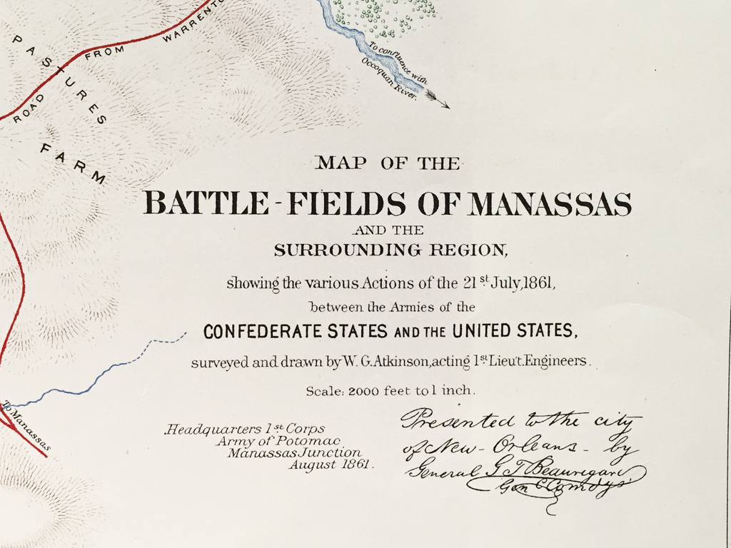
Original antique lithograph Plans of the Battlefield at Bull Run and Manassas from 1891. Plate III. From the United States War Department’s Atlas to Accompany the Official Records of the Union and Confederate Armies 1861 – 1865, published in 1891. Published under the direction of the Hons. Redfield Proctor, Stephen B. Elkins and Daniel S. Lamont, Secretaries of War; by Maj. George B. Davis, U.S. Army, Mr. Leslie J. Perry, civilian expert, Mr. Joseph W. Kirkley, civilian expert, Board of Publication.
FULL TITLE
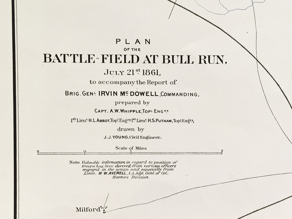
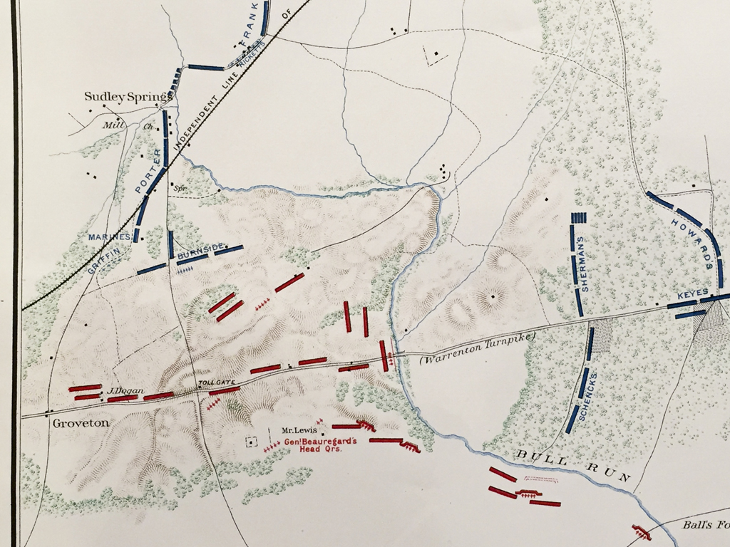
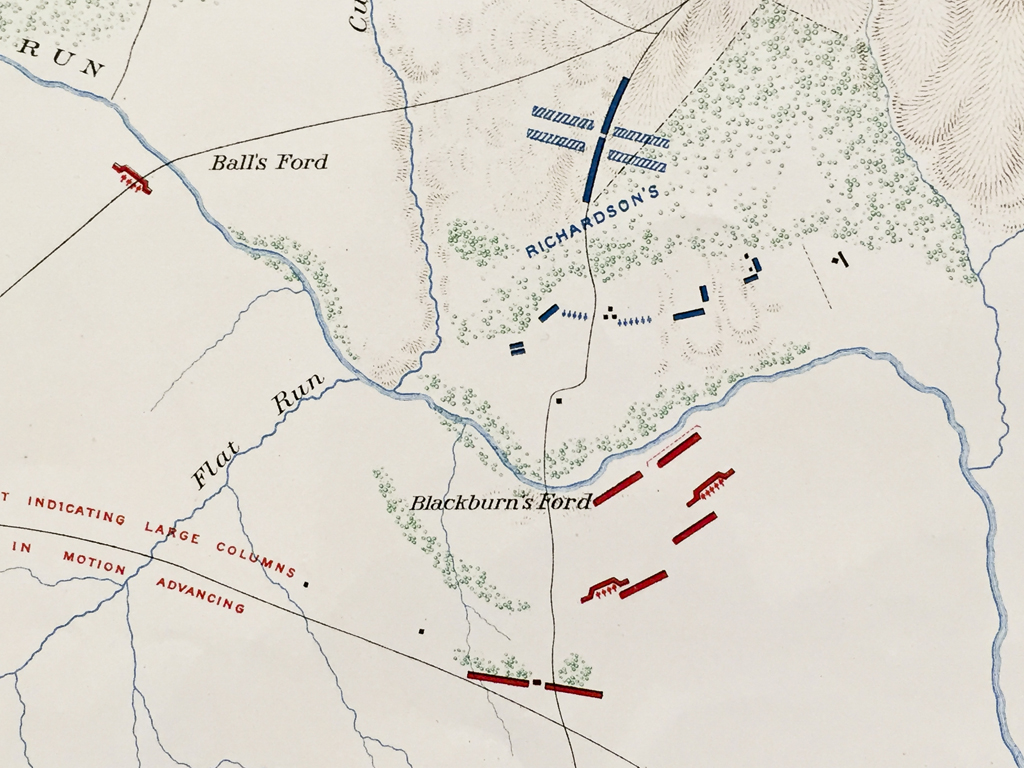
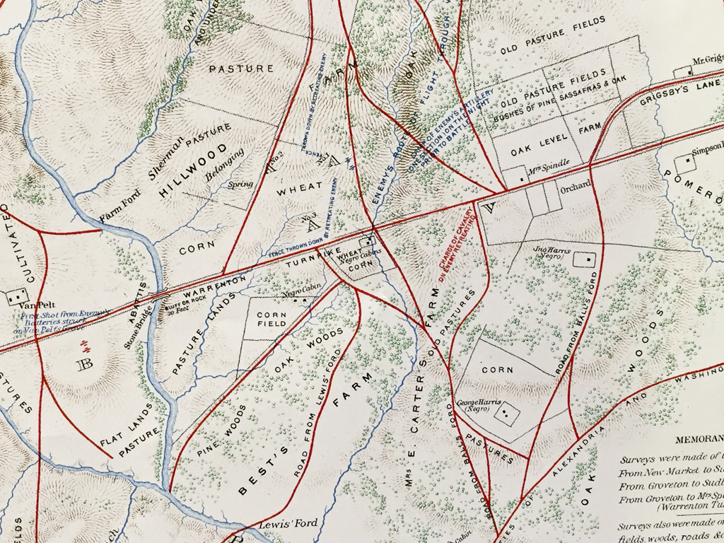
Plan of the Battle-Field at Bull Run. July 21st 1861 to accompany the report of Brig. Gen. Irvin McDowell, Commanding, prepared by Capt. A.W. Whipple, Top. Eng. 1st Lieut. H.L. Abbot, Top Eng. 1st Lieut. H.S. Putman, Top Eng., drawn by J.J. Young, Civil Engineer.
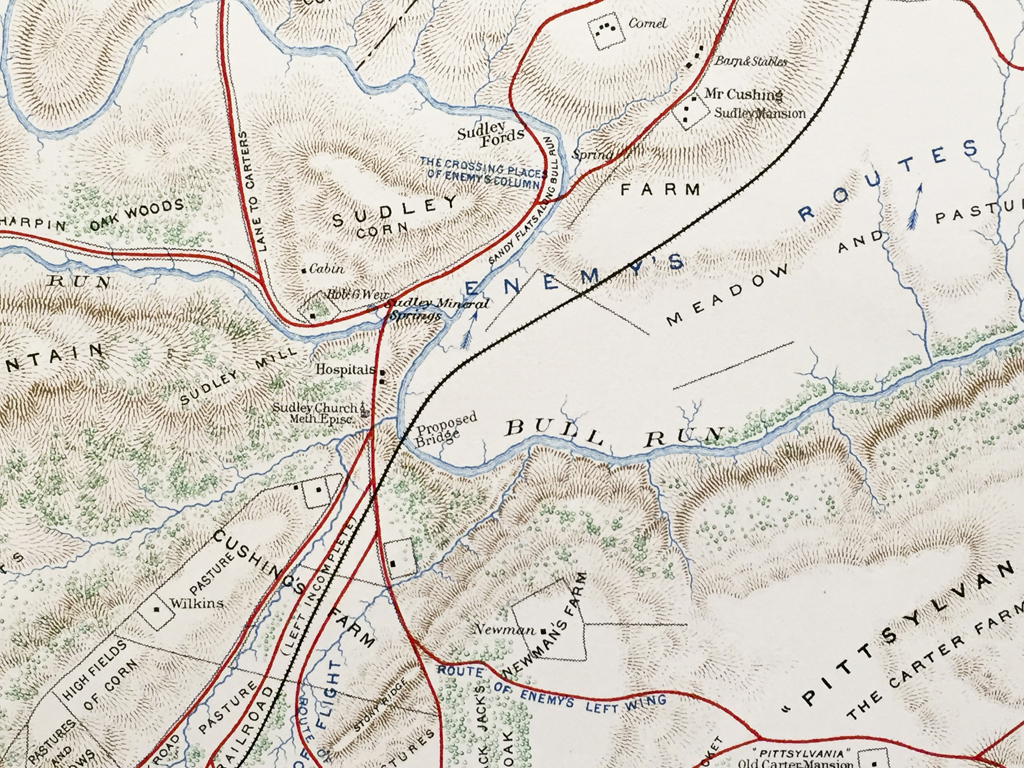
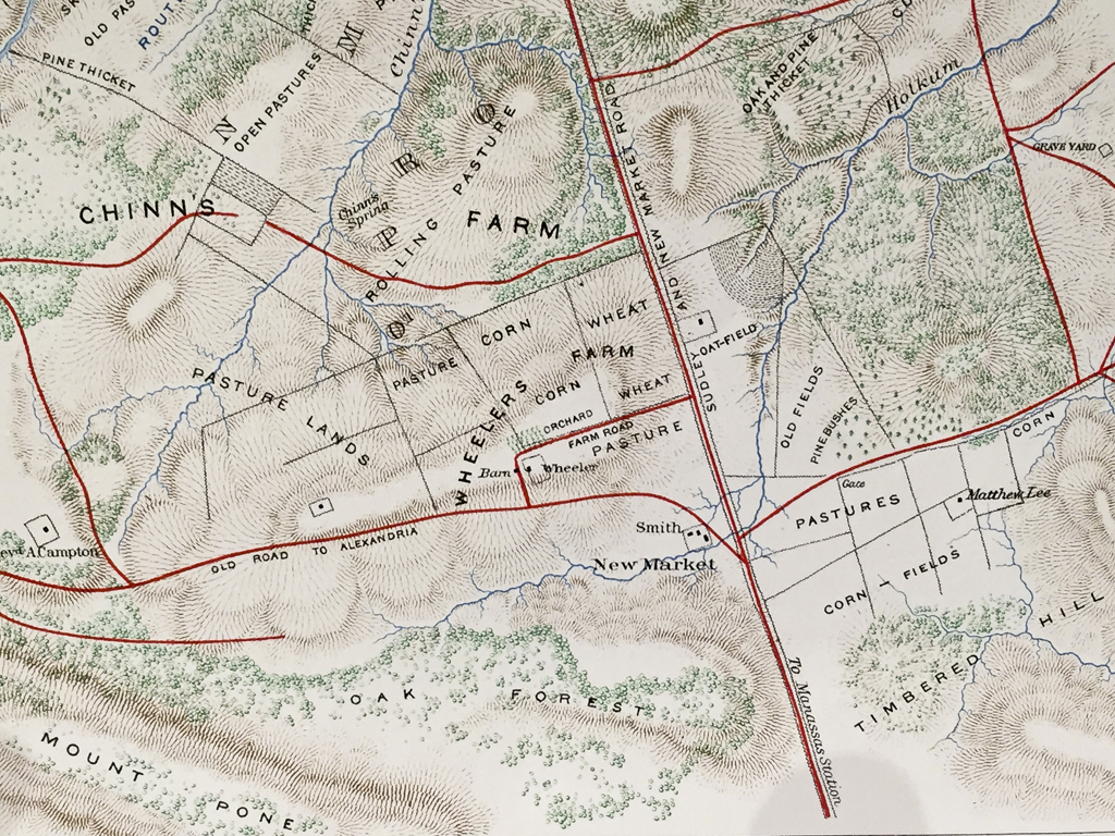
Map of the Battle-Field of Manassas and the Surrounding Region showing the various Actions on the 21st July, 1861, between the Armies of the Confederate States and the United States surveyed and drawn by W.G Atkinson, acting 1st Lieut, Engineers.
Scale: 2000 feet to 1 inch.
Lithograph by Julius Bien & Co. Lith. N.Y.
Series 1 Vol 2. Page 317
Out of stock
| Weight | 2.00 lbs |
|---|---|
| Catalog: | HISTMapMilitary-002 |
| Dimensions: | 29"W x 18 1/4"H |