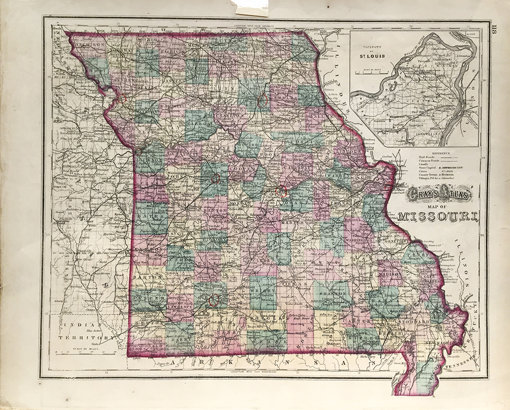


Missouri State Map (1872)
$180.00
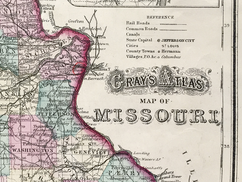
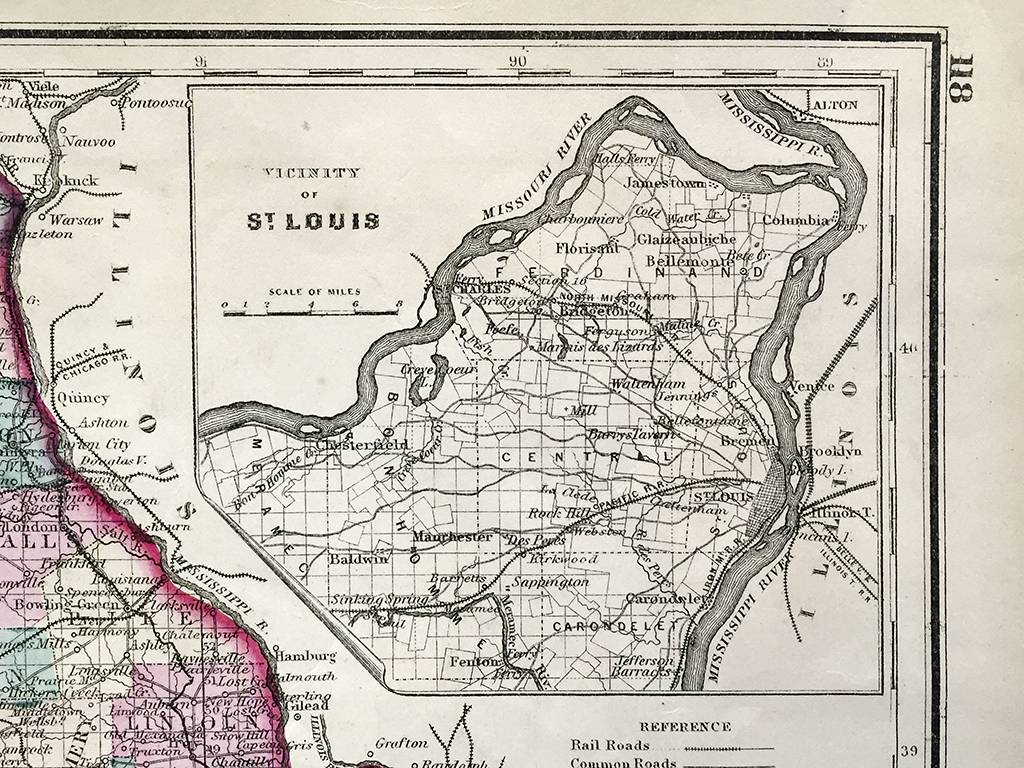
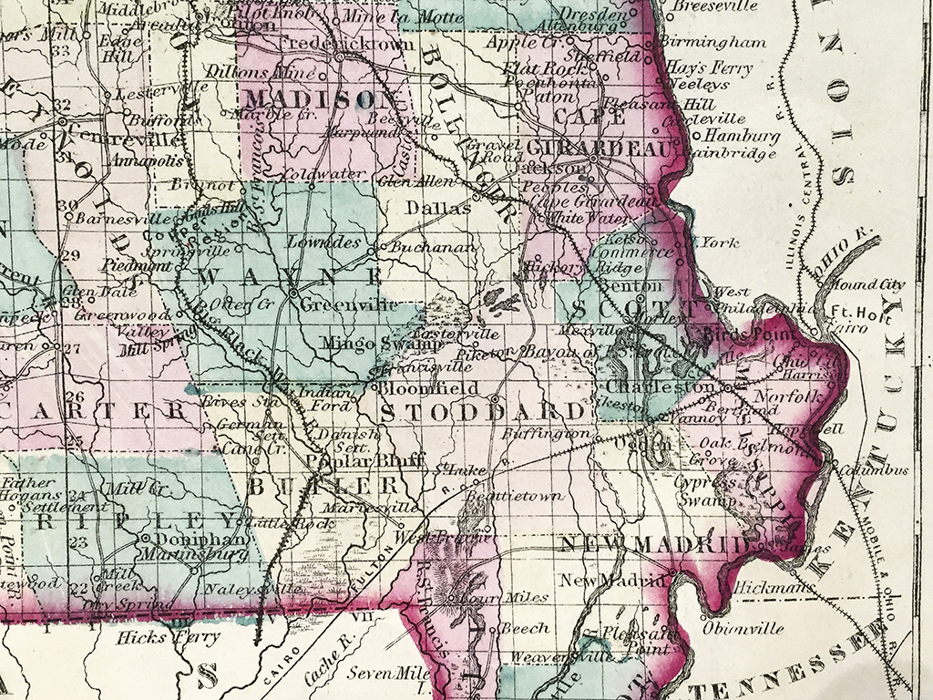
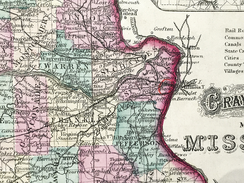
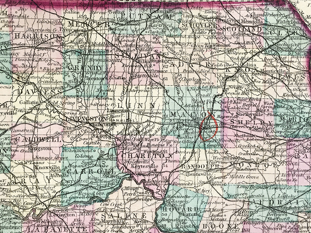
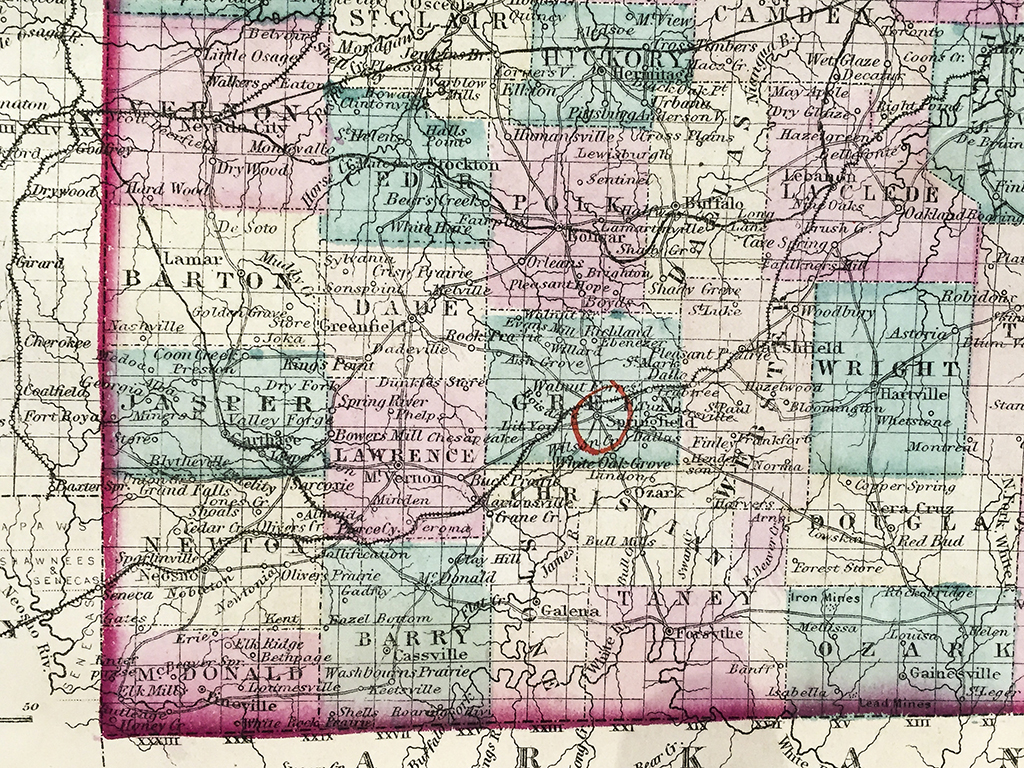
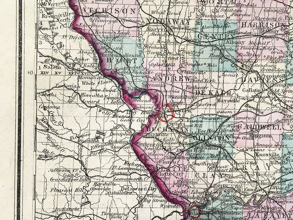
Original antique hand-colored steel-plate engraved map of Missouri and vicinity from 1872 published by Ormando W. Gray, Philadelphia, PA with an insert of the city of St. Louis and vicinity. Each county is distinguished by individual color with cities, towns, roads, and rail lines acutely illustrated. Gray was one of the most successful atlas publishers of the 1870s and one of the last to employ hand coloring on his maps. These maps are now highly sought after by historians and map collectors alike.
In stock
Additional information
| Weight | 1.00 lbs |
|---|---|
| Catalog: | HISTMapState-003 |
| Dimensions: | 16 7/8"W x 13 1/2"H |