


California State Railroad Map (c.1907)
$150.00
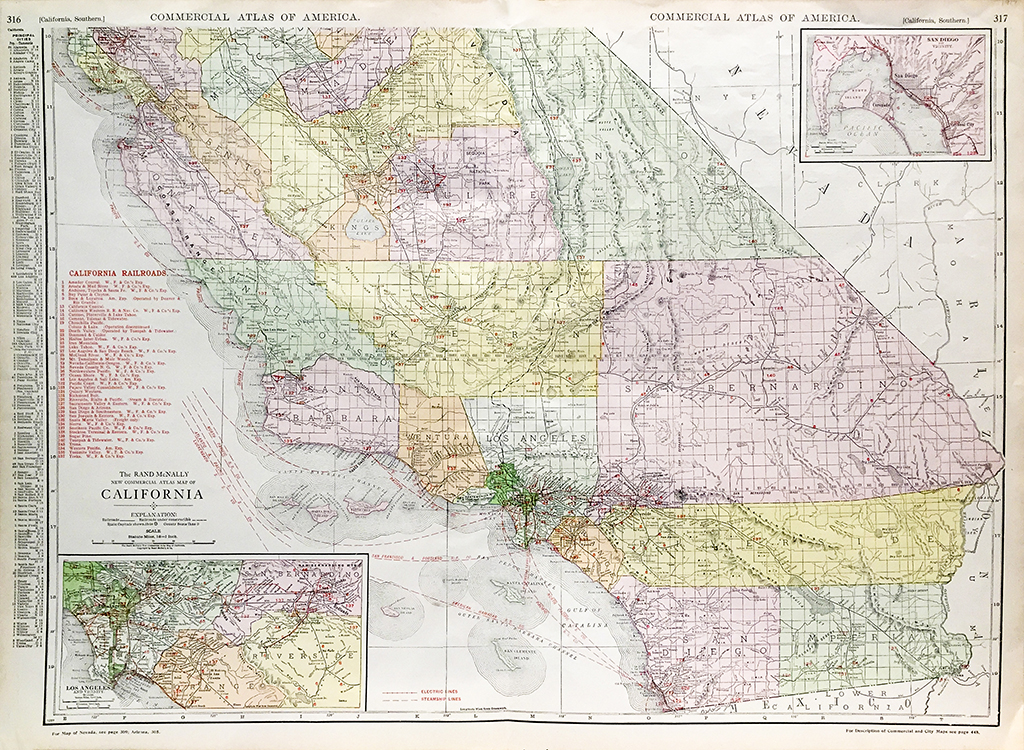
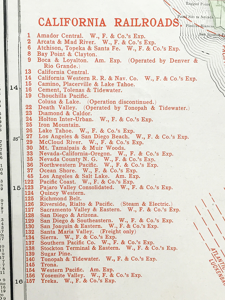
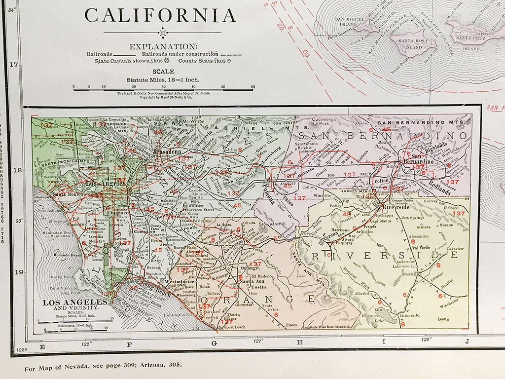
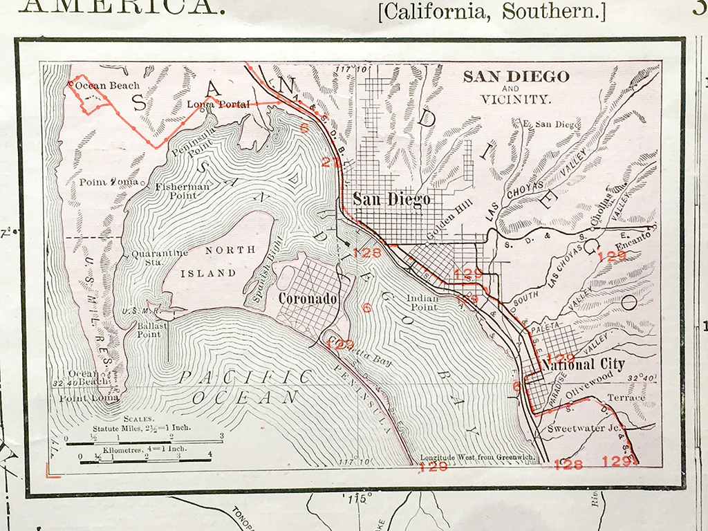
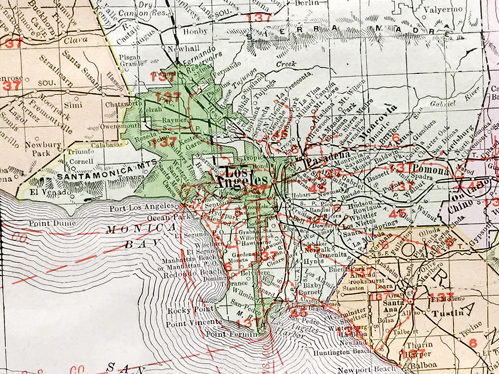
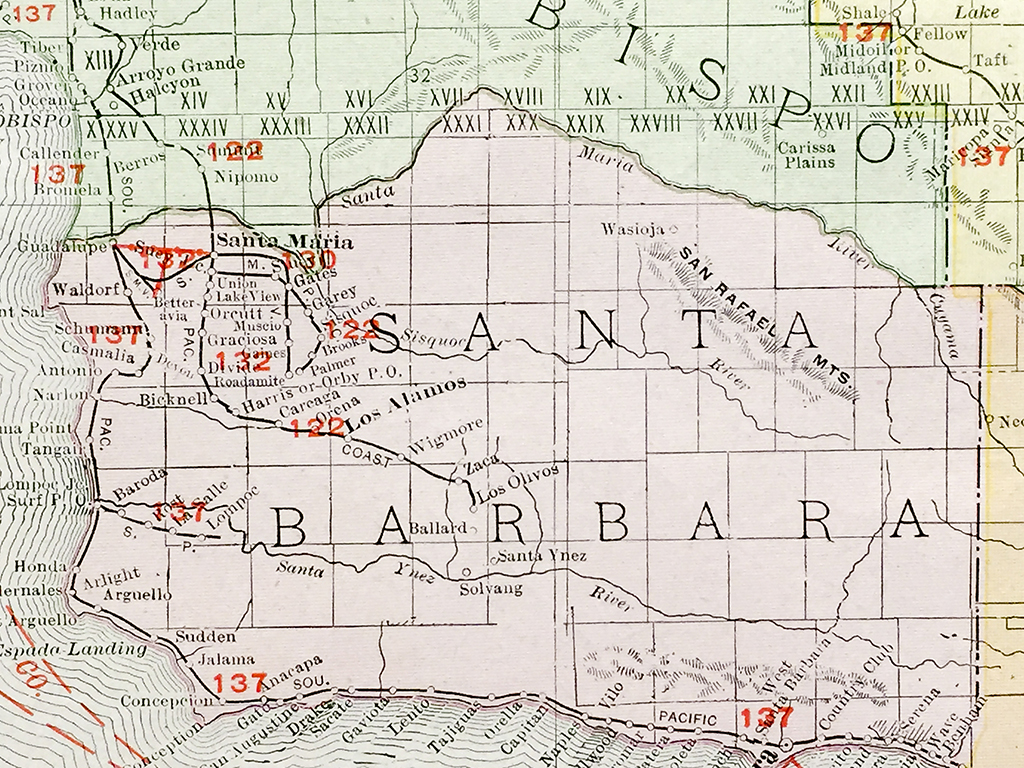
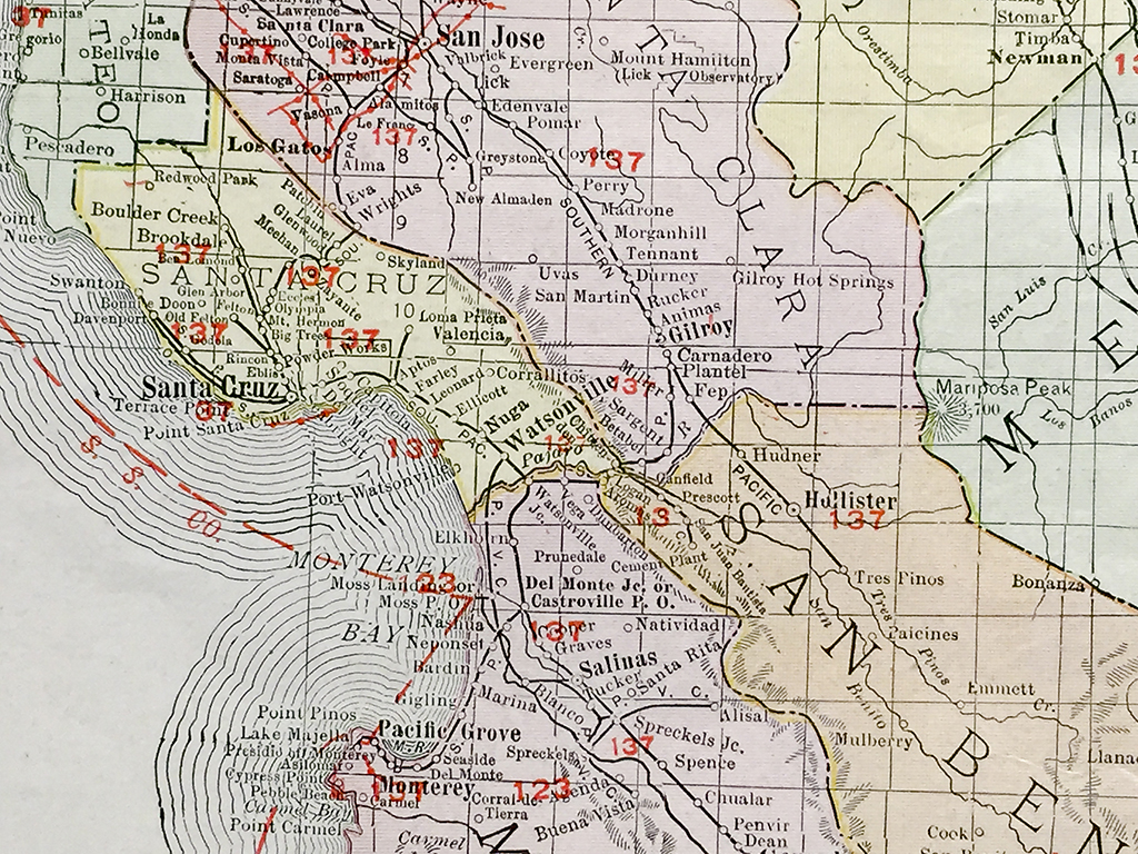
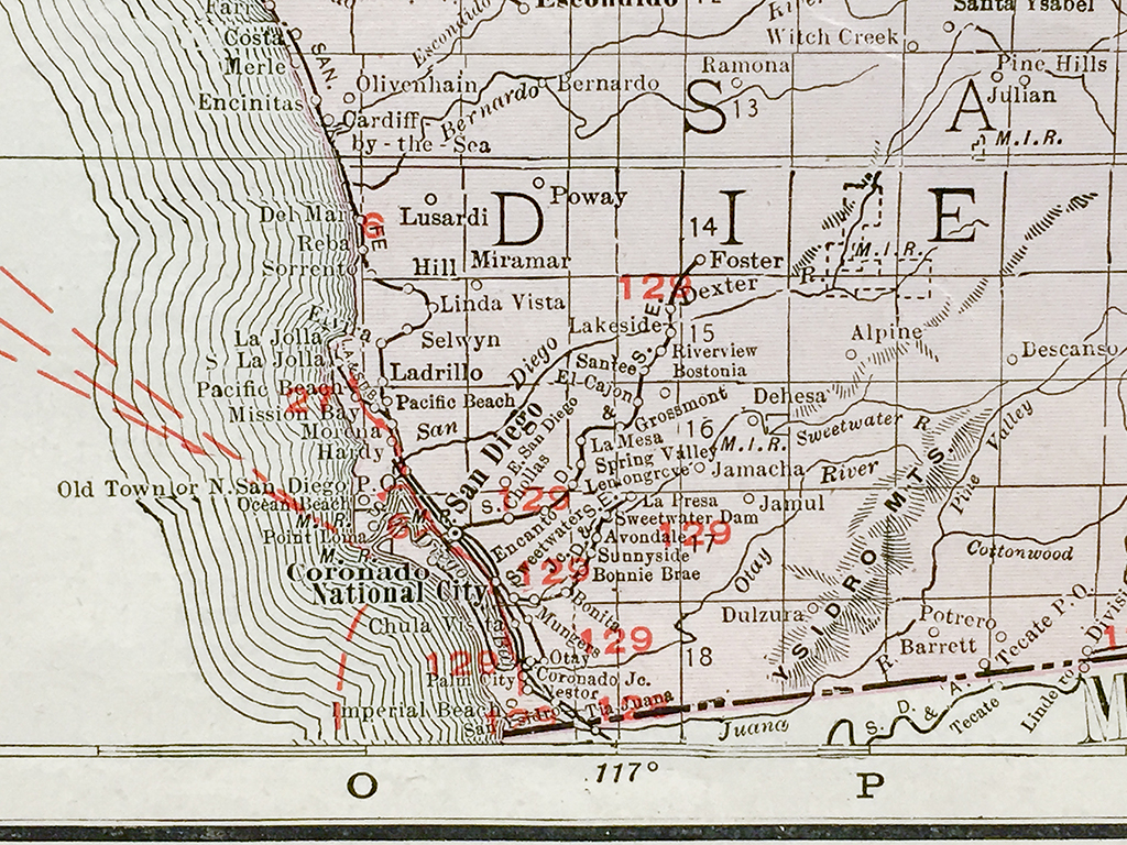
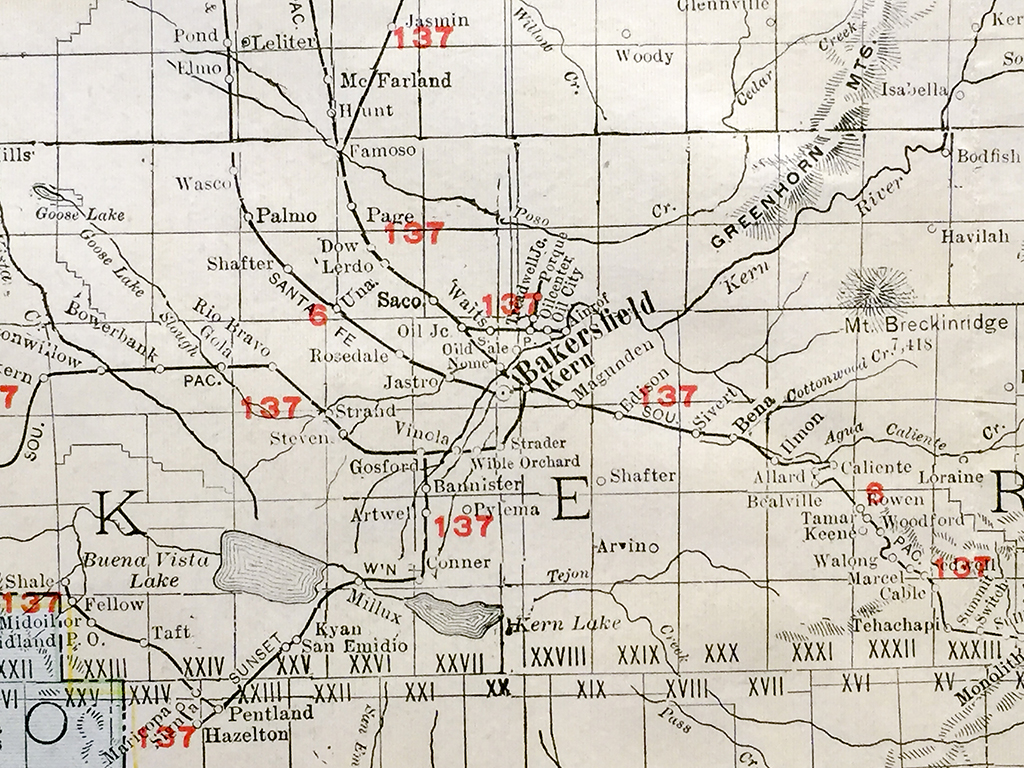
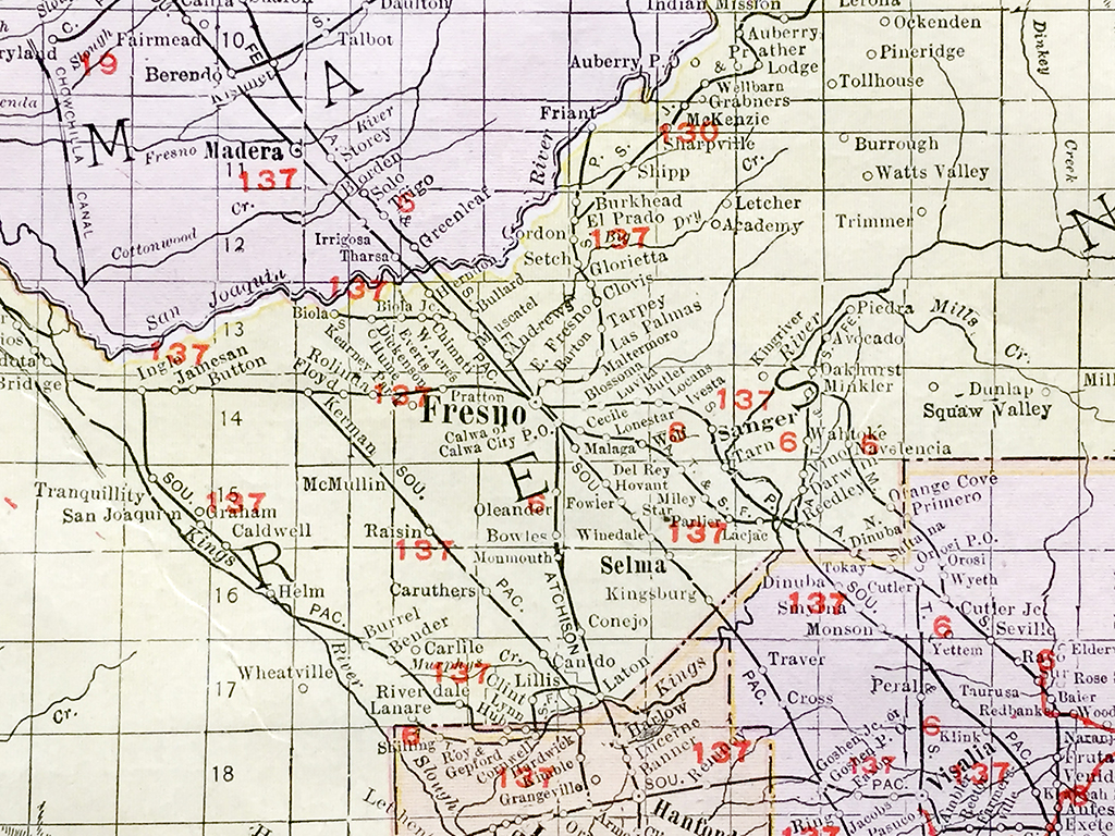
Original color antique Southern California state railroad map and vicinity from c. 1917 published by Rand McNally & Co. with insert detailed sections of the Los Angeles and San Diego. Detailed map of California’s railroad line at the turn of the twentieth century including Western Pacific, Camino, Placerville and Lake Tahoe, Southern Pacific, and the Atchison, Topeka & Santa Fe.
In stock
Additional information
| Weight | 2.00 lbs |
|---|---|
| Catalog: | HISTMapState-018 |
| Dimensions: | 28"W x 20 1/2"H |