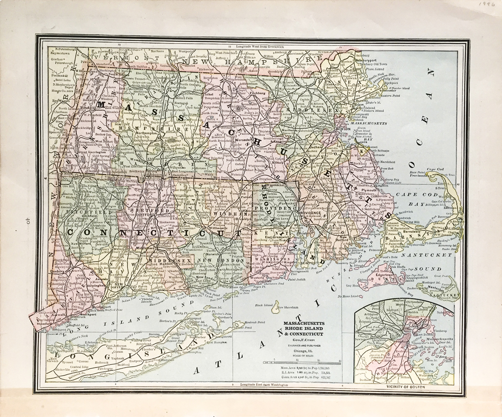
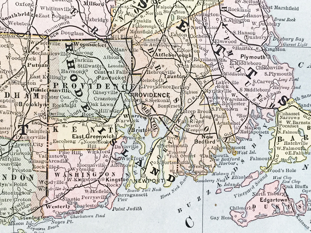
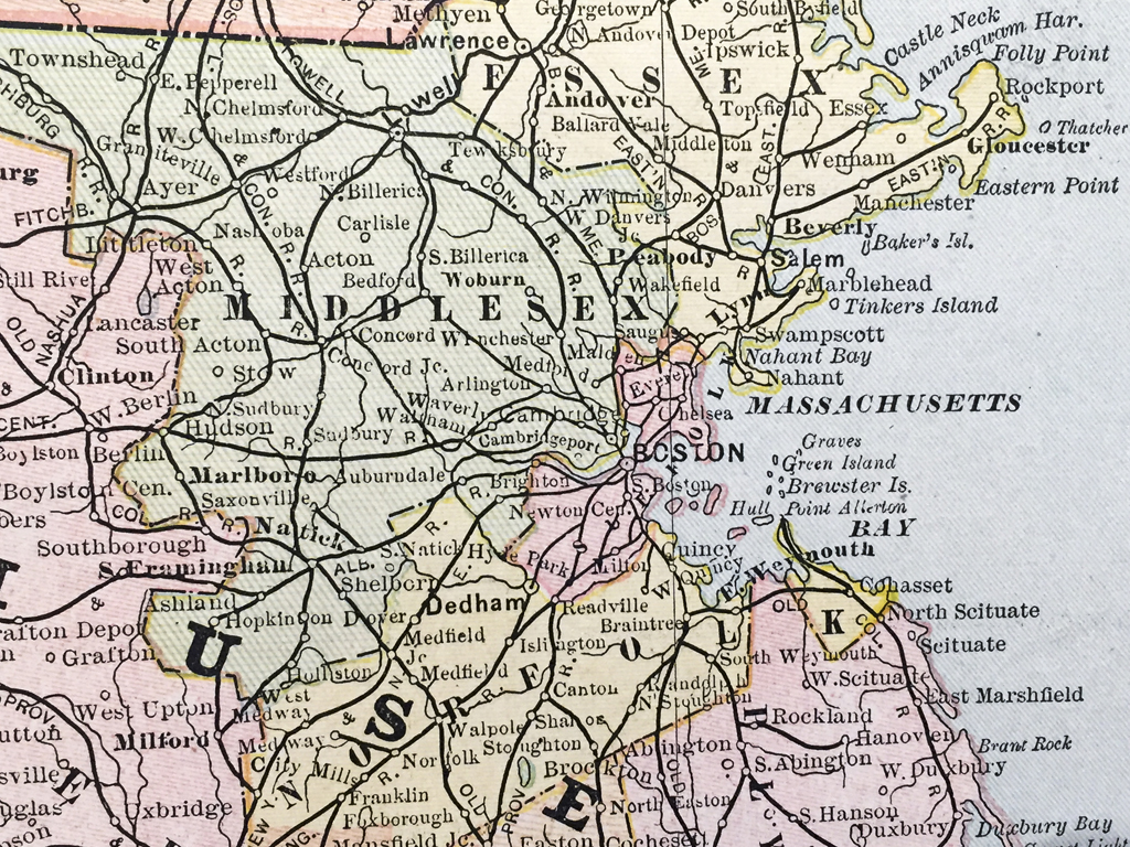
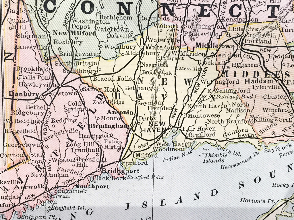
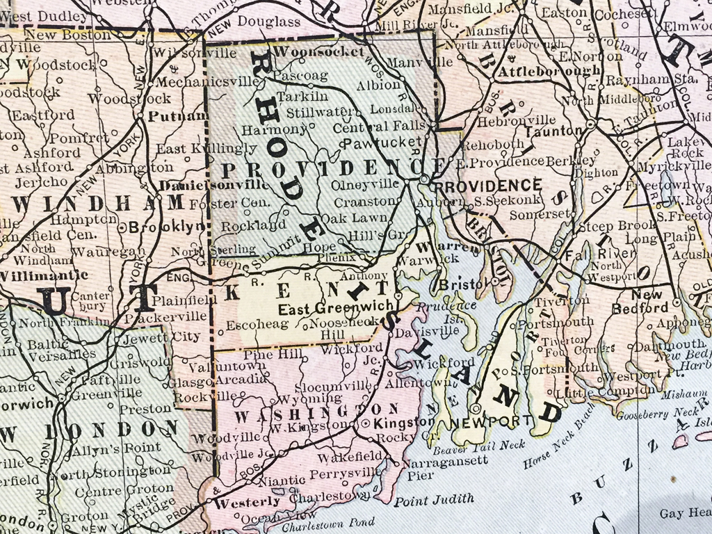


Massachusetts, Connecticut, Rhode Island State Map (1886)
$120.00
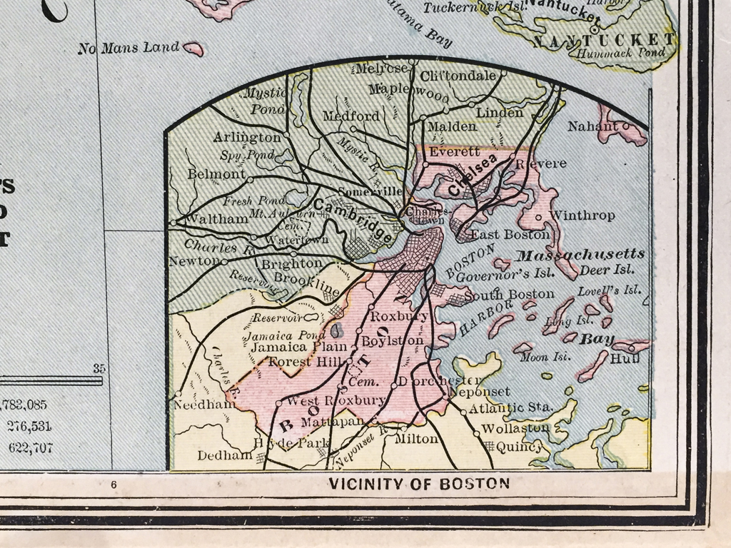
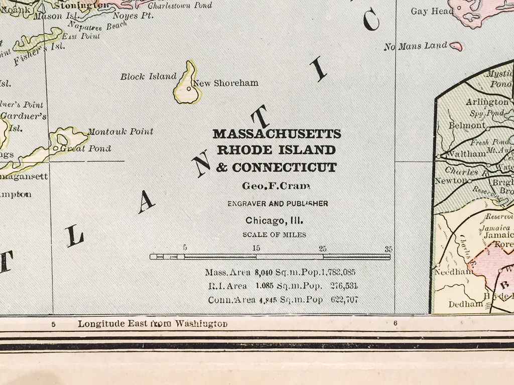
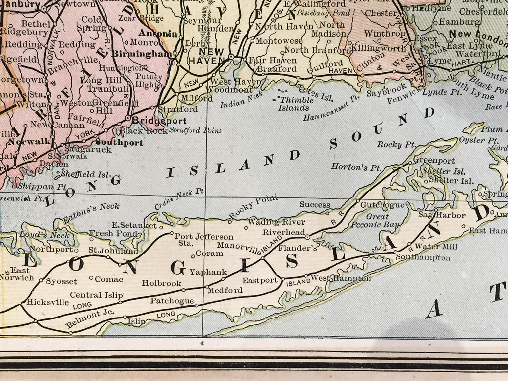
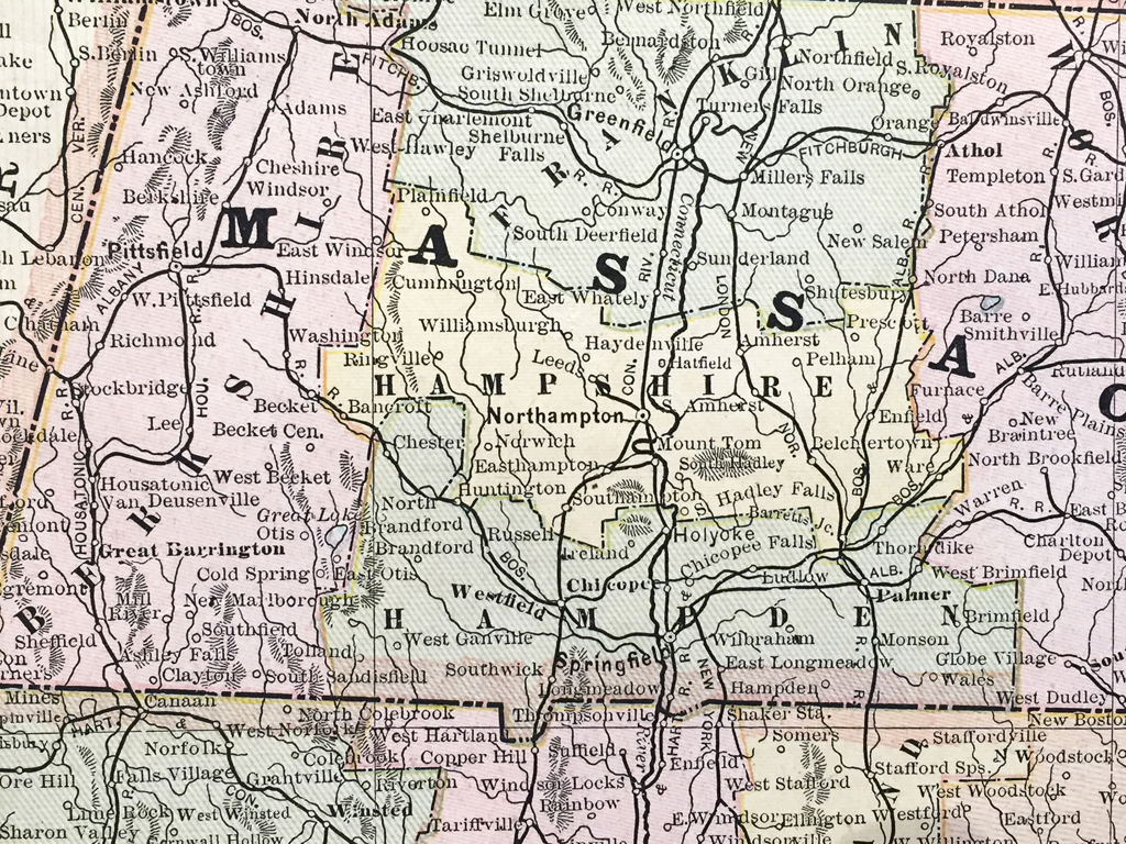
Original color antique Massachusetts, Connecticut, and Rhode Island state map and vicinity from 1886 published and engraved by George F. Cram Chicago, IL with insert detailed section of Boston, Massachusetts and vicinity. George F. Cram began producing maps after serving in the American Civil War. Cram initially produced maps for traveling salesmen but after the great Chicago fire of 1871 re-established the company producing and selling colorful maps and atlases. The company has now become one of the leading map and globe firms in the United States.
Out of stock
Additional information
| Weight | 1.00 lbs |
|---|---|
| Catalog: | HISTMapState-011 |
| Dimensions: | 13 1/2"W x 11 1/2"H |