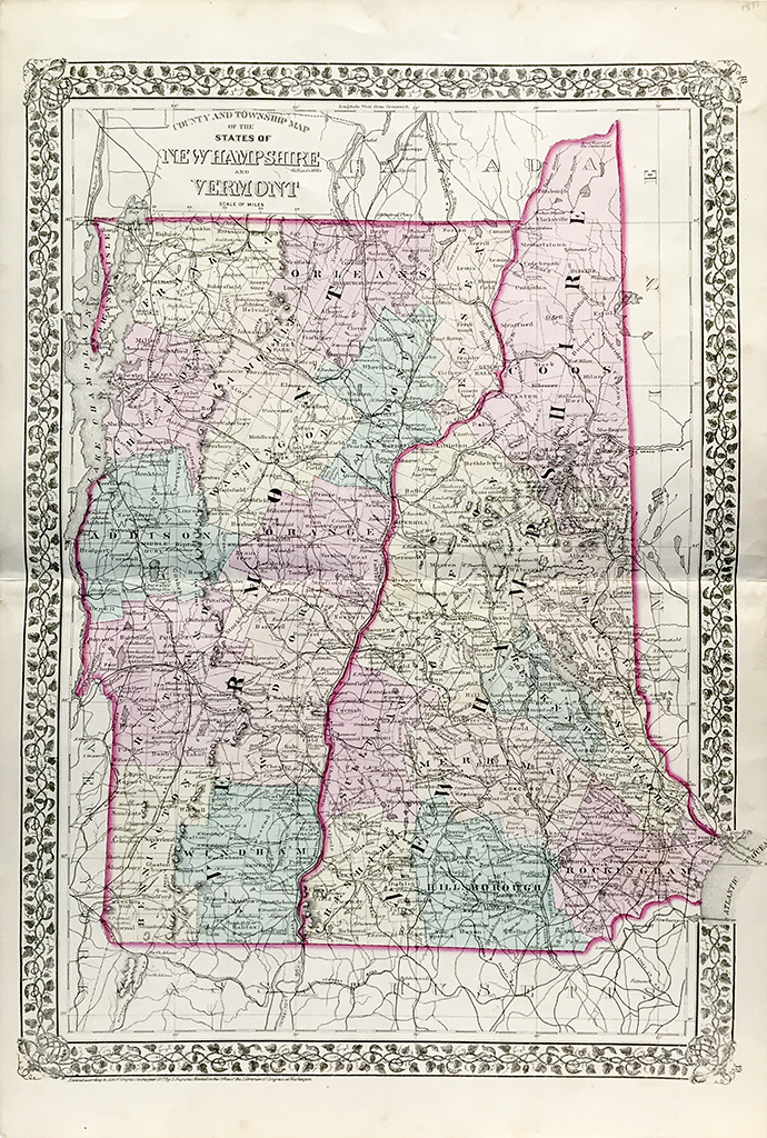
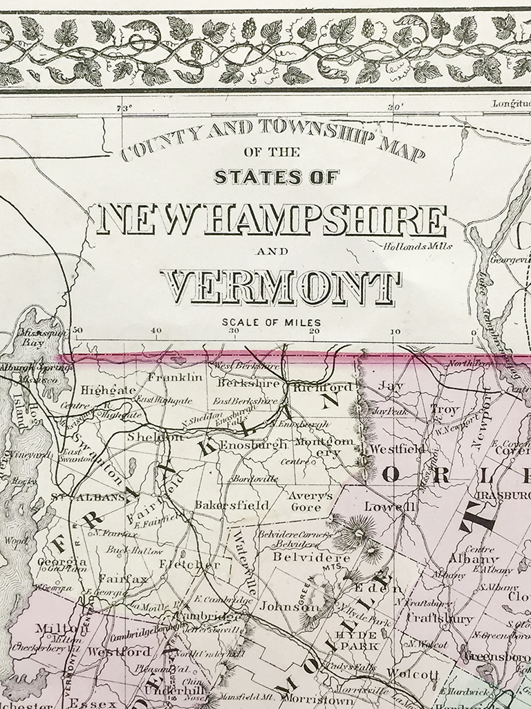
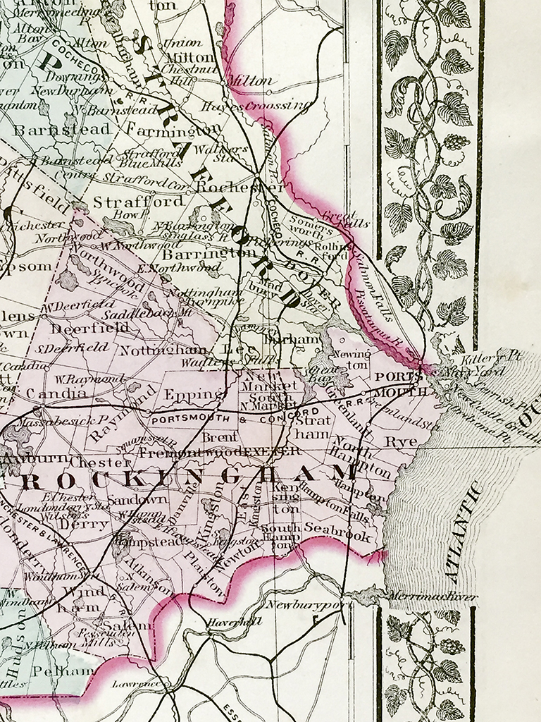
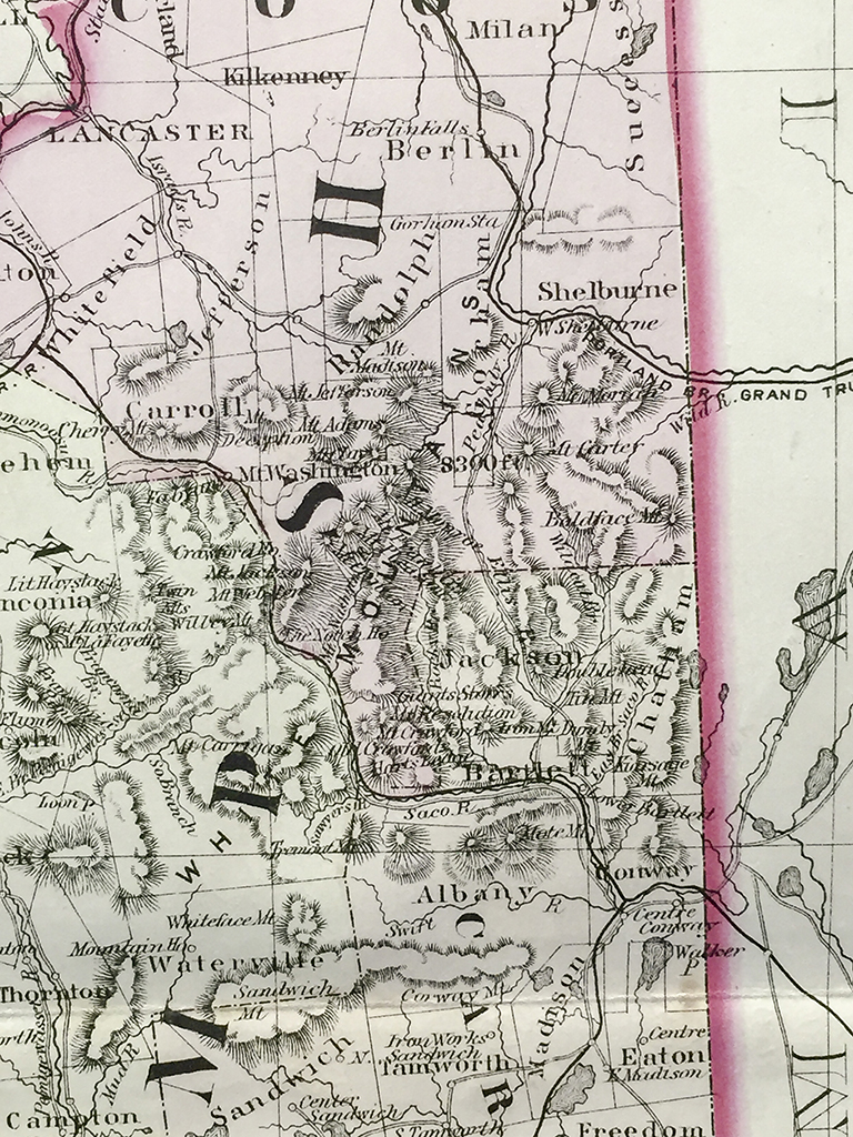


Vermont and New Hampshire State Map (1877)
$160.00
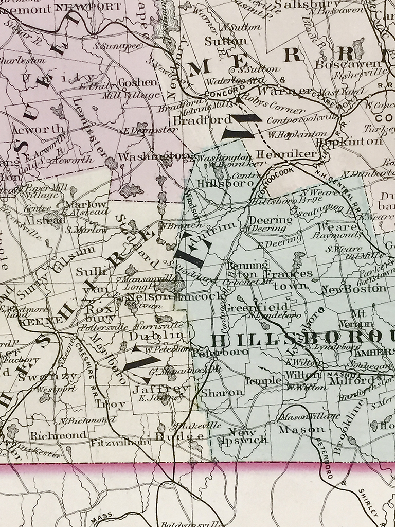
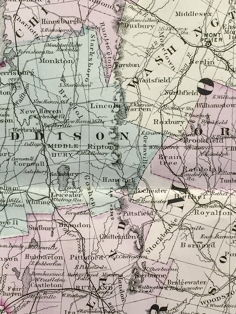
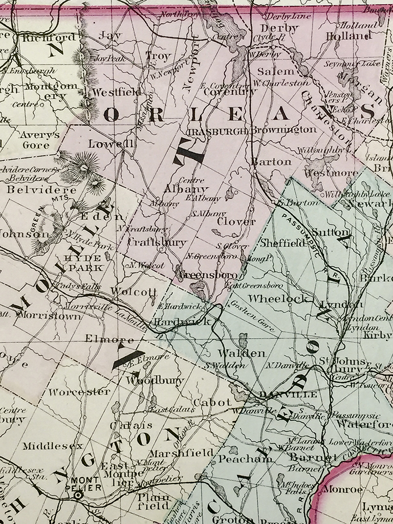
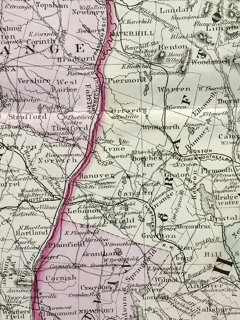
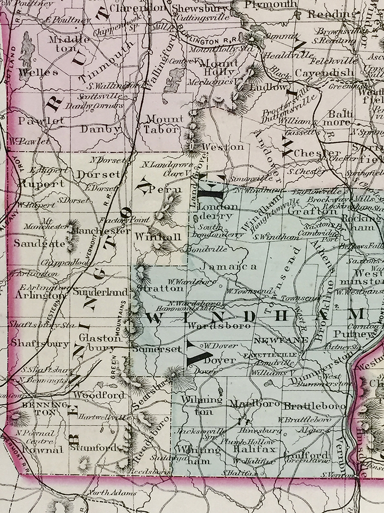
Original antique hand-colored steel-plate engraved map of Vermont and New Hampshire and vicinity from 1877 published by S. Augustus Mitchell. Each county is distinguished by individual color with cities, towns, roads, and rail lines acutely illustrated. One of the most attractive American atlas maps of this region to appear in the mid 19th century. Features the vine motif border typical of Mitchell maps from the 1866 – 1882 period. Prepared by S.A. Mitchell for inclusion as plate nos. 18 and 19 in the 1878 issue of “Mitchell’s New General Atlas, Containing maps of the Various Countries of the World, Plans of Cities, Etc,…” These maps are now highly sought after by historians and map collectors alike.
In stock
| Weight | 2.00 lbs |
|---|---|
| Catalog: | HISTMapState-016 |
| Dimensions: | 15 1/8"W x 23"H |