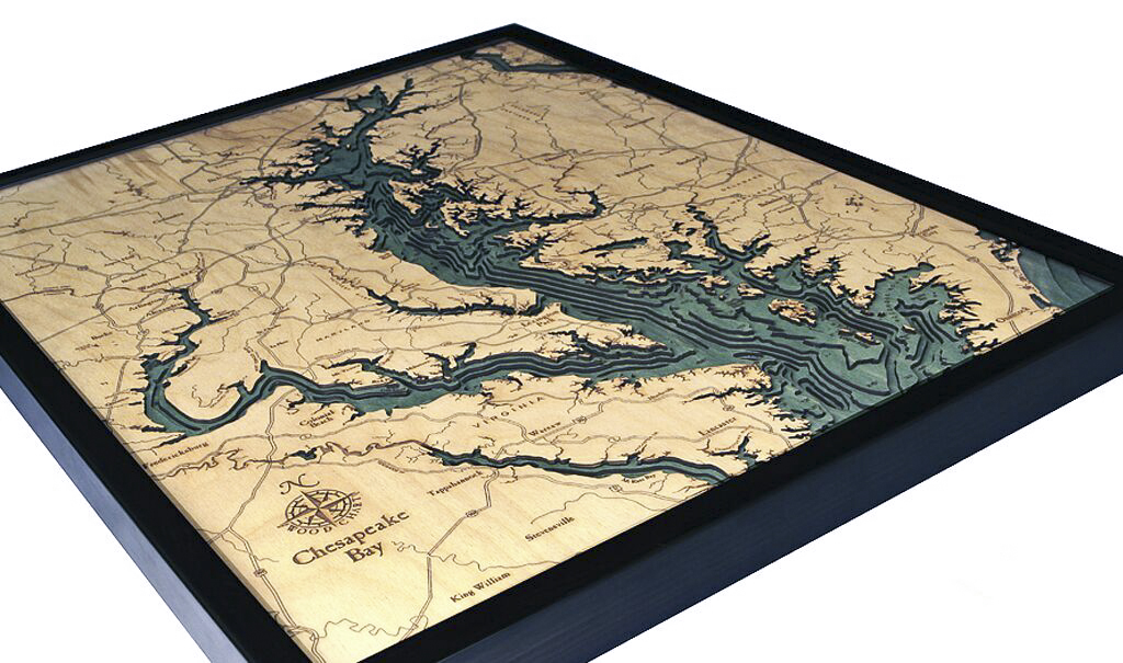
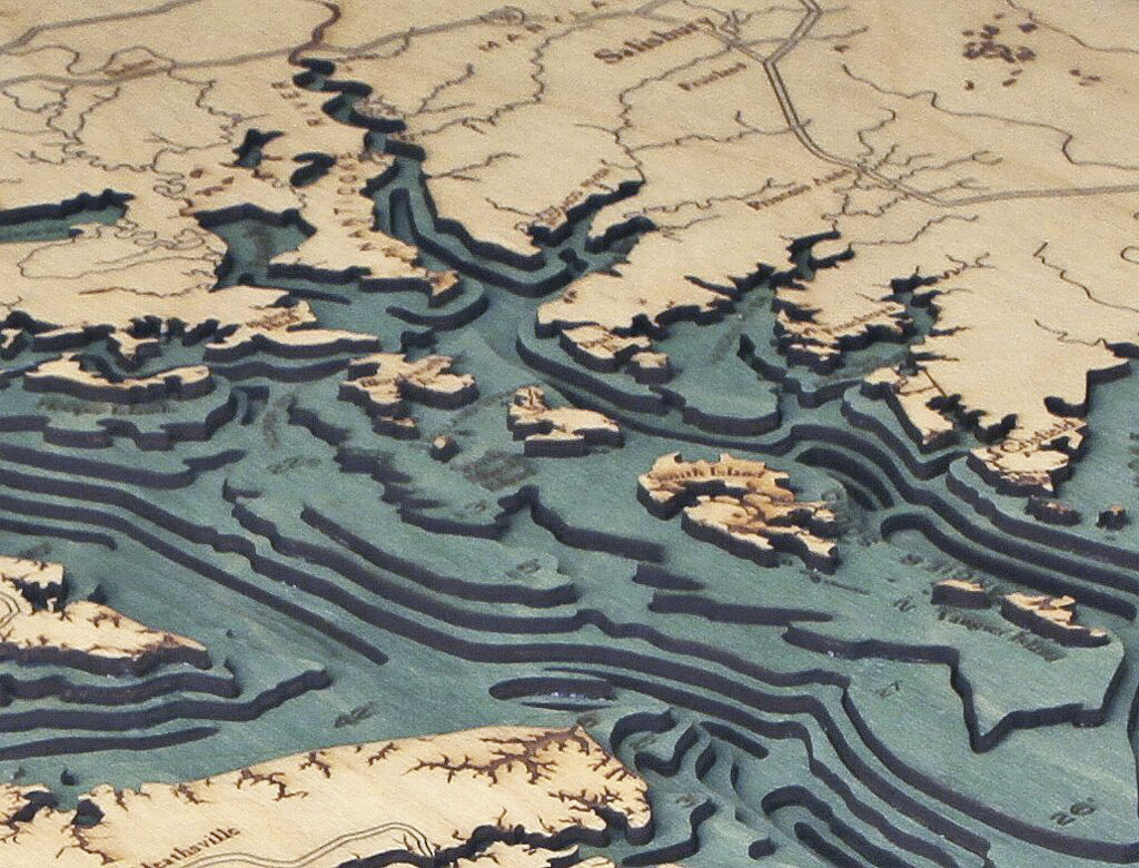

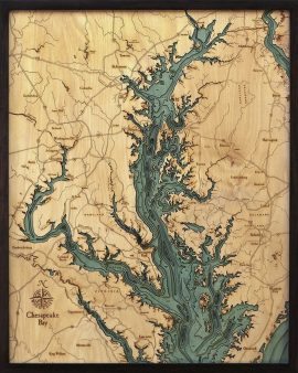


Bathymetric Map Chesapeake Bay, Maryland
$332.00
Extremely accurate bathymetric map of the Chesapeake Bay and surrounding area. More than 150 rivers and streams drain into Chesapeake Bay, the largest estuary in the United States. It drains a basin of over 64,000 square miles into the Atlantic Ocean, but it’s actually quite shallow. Its average depth is only 21 feet and almost a quarter of the bay is less than 6 feet deep.
During the last ice age, sea levels were much lower than they are today and the bay was actually a river basin. When the ice receded and sea levels rose, it filled in the bay and left the channel of the Susquehanna down below as evidence of its prehistoric past. In geologic terms, this is what’s called a “ria” (a drowned river valley).
This three dimensional map is carved from Baltic birch wood, framed and has a acrylic covering to protect the wood. Professional cartographers are used in the creation of each individual chart in order to insure the utmost accuracy. Some maps come in two sizes in order to fit virtually any area in the home, office or boat. We have charts from areas across the U.S. available on a drop ship basis. This is a great item at an unbelievable price. If you are searching for a particular area, please call or email.
The color will differ slightly with both the frame and background as each of the maps are hand stained and may vary from the picture.
| Weight | 7.00 lbs |
|---|---|
| Catalog: | BC-ChesapeakeBay |
| Dimensions: | 24.5"W x 31" H |